Two forecasts, same number: a quarter-inch. One is a nuisance you might not even roll for. The other is the event that generates the slip-and-fall claim. The total told you nothing — the precipitation type told you everything.
Different failure modes entirely
Snow is a volume problem. It accumulates, you move it, and the main variables are how much, how fast, and whether you can stay ahead of it. Timing matters, but the failure mode is mostly falling behind.
Ice is a bond problem. The quantity is almost irrelevant; what matters is whether liquid water freezes on contact with the pavement and bonds to it. Once that bond sets, you’re no longer moving material — you’re breaking a mechanical connection, and a plow blade is a poor tool for that. This is why a trace of freezing rain can be a worse operational event than four inches of snow, and why the guy who judged the night on the storm total is the guy still out there at 6 a.m.
Why pavement temperature is the pivot
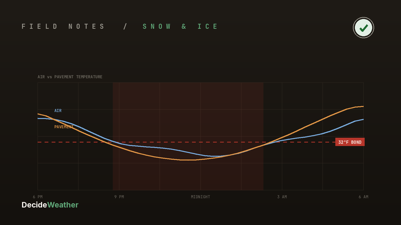
The variable that separates the two isn’t air temperature — it’s pavement temperature, and the two diverge constantly. Pavement holds heat from the day, radiates it overnight, and responds slowly. A surface at 34°F with air at 30°F gives you wet pavement. The same air over pavement that’s dropped to 30°F gives you a sheet.
That’s also the entire logic of pre-treating. Anti-icing works by putting brine down before precipitation so the bond never forms in the first place. It’s cheap, it’s fast, and it’s dramatically more effective than deicing after the fact — but only inside a window. Too early and traffic and wind scatter it, or a light rain washes it off, and you’ve spent product for nothing. Too late and the bond has already set; now you’re deicing, which needs far more material and far more time.
So the pre-treat call is genuinely a forecast problem: when does precipitation start, what type will it be at that hour, and where is pavement temperature heading between now and then.
The transitions are where events are lost
The hardest nights aren’t the pure ones. They’re the ones that change type mid-event — snow that goes over to sleet, rain that flips to freezing rain as temperatures fall behind a front. Those transitions can invalidate a plan made six hours earlier, and they’re exactly where a storm-total forecast is least useful.
- Snow: volume and timing — can you stay ahead of the rate
- Freezing rain: bond risk — pre-treat inside the window or accept a deicing event
- Sleet: a hybrid, and often the most misread of the three
- Mid-event transitions: the plan has to change when the type does
- Pavement temperature: the variable that decides which event you’re actually having
The forecast that helps you isn’t a number of inches. It’s precipitation type by hour, against pavement temperature by hour, with enough lead time that pre-treating is still an option rather than a missed one.